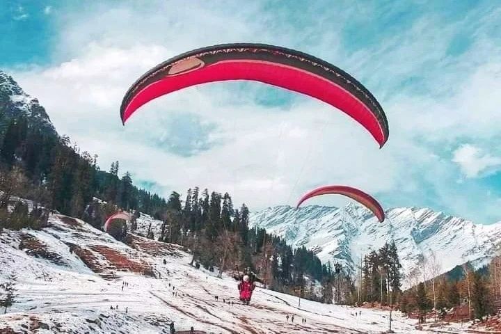
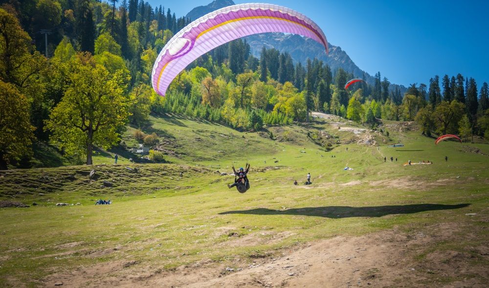
Paragliding is a recreational aerial sport that allows individuals to glide through the air using a lightweight wing. Valley environments are among the most popular locations for this activity due to their favorable natural conditions.
Common Features of Valley Paragliding Locations
-
Wide open launch areas on hillsides
-
Stable and predictable air currents
-
Clear landing zones at lower elevations
-
Scenic landscapes enhancing the flying experience
These features make valleys ideal for both beginners and experienced pilots, offering safer and more controlled flight conditions.
Why Paragliding Over Valleys Matters
Paragliding over valleys is more than just an adventure activity—it is part of a broader field of aerial sports and outdoor recreation.
Key reasons for its growing popularity:
1. Unique Perspective of Nature
Paragliding provides a bird’s-eye view of landscapes, offering an experience that differs significantly from hiking or ground-based exploration.
2. Learning Atmospheric Science
Pilots develop knowledge of:
-
Thermals (rising warm air)
-
Wind patterns and gradients
-
Ridge lift and airflow dynamics
This understanding improves both safety and environmental awareness.
3. Contribution to Tourism
Valley regions suitable for paragliding often become hubs for:
-
Training schools
-
Adventure tourism
-
Competitions and events
This supports local economies and infrastructure development.
4. Skill Development and Training
Paragliding encourages structured learning, including:
-
Flight theory
-
Equipment handling
-
Emergency response techniques
It also promotes responsible outdoor recreation and environmental respect.
Recent Developments and Trends
Paragliding technology and training methods have evolved significantly in recent years.
Key trends include:
Improved Wing Design
Modern wings offer:
-
Better aerodynamic efficiency
-
Higher glide ratios
-
Increased stability in turbulent air
Digital Flight Instruments
Pilots now use GPS-based tools and apps to monitor:
-
Altitude
-
Wind speed
-
Flight path and performance
Safety-Focused Training
Training programs now emphasize:
-
Ground handling skills
-
Weather analysis
-
Emergency descent techniques
-
Equipment inspection
Flight Data and Analytics
Pilots increasingly track performance metrics to improve skills.
Common Flight Metrics
| Metric | Purpose | Insight |
|---|
| Altitude Gain | Measures climb efficiency | Identifies strong thermals |
| Flight Duration | Indicates endurance | Finds optimal conditions |
| Glide Ratio | Distance vs altitude loss | Evaluates wing performance |
| Speed Over Ground | Travel speed | Aids navigation |
Environmental Monitoring
Weather stations and wind sensors near launch sites provide real-time data, improving flight planning and safety.
These developments have made paragliding more accessible while enhancing safety and performance.
Aviation Rules and Safety Frameworks
Paragliding falls under recreational aviation and is guided by safety regulations to protect both pilots and the public.
Common regulatory areas include:
-
Pilot training certification
-
Approved flight zones and airspace limits
-
Equipment safety standards
-
Event and competition guidelines
Safety equipment often includes:
-
Helmets designed for aerial sports
-
Reserve parachutes for emergencies
-
Radio communication devices
-
Visibility and tracking equipment
Training programs usually combine theory and supervised practice to ensure pilots understand both aerodynamics and weather conditions.
Airspace awareness is essential, as paragliders may share airspace with helicopters, gliders, and small aircraft.
Tools and Resources for Paragliding
Various tools help pilots plan flights, monitor conditions, and improve skills.
Common tools include:
Weather Forecast Platforms
-
Analyze wind direction, speed, and thermal activity
GPS Flight Instruments
-
Track altitude, speed, and route
Airspace Maps
-
Identify restricted or controlled zones
Flight Log Platforms
-
Store and analyze past flights
Training Resources
-
Manuals and tutorials explaining aerodynamics and safety
Tool Overview
| Tool Category | Purpose |
|---|
| Weather Apps | Predict wind and thermal conditions |
| GPS Instruments | Monitor flight performance |
| Airspace Maps | Ensure safe navigation |
| Flight Logs | Analyze performance data |
| Training Guides | Build foundational knowledge |
These resources support both beginners and experienced pilots in making informed decisions.
Frequently Asked Questions
What makes valleys ideal for paragliding?
Valleys create natural lift through thermals and slope winds, allowing pilots to stay airborne longer while maintaining stable flight conditions.
Is training required?
Yes. Beginners must undergo structured training that includes theory, supervised flights, and safety procedures.
What equipment is needed?
Basic equipment includes a paraglider wing, harness, helmet, reserve parachute, and often GPS instruments.
How important is weather?
Weather is critical. Pilots must evaluate wind speed, direction, thermal activity, and atmospheric stability before flying.
Can beginners fly in valleys?
Beginners usually start with short, supervised flights and gradually progress to longer valley flights as they gain experience.
Conclusion
Paragliding over valleys offers a unique combination of adventure, environmental awareness, and technical skill. The natural conditions found in valleys make them ideal for safe and controlled flights, while also providing stunning visual experiences.
Advancements in equipment design, digital tools, and structured training have improved both accessibility and safety. At the same time, aviation regulations and safety frameworks ensure responsible participation in the sport.
By understanding flight principles, weather patterns, and safety practices, individuals can explore paragliding as a structured and informed outdoor activity.